47-039-02026 in 1997
When we purchased our land in 1984 there was an existing gas well halfway between the hard road and the center of our property. At that time we could drive a car to the gas well without any problem. By 1997 the road had gotten a lot worse. A whole lot worse.
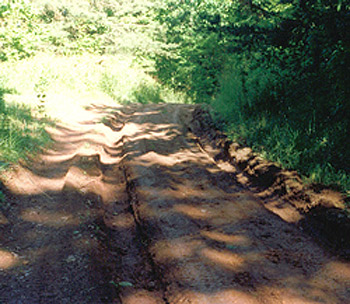
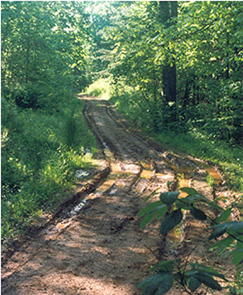
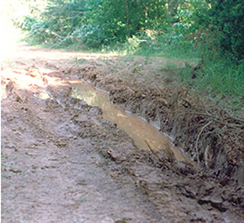
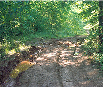
We took photographs in 1997, in the end of May, to document the condition of the road. We'd made a complaint to the state's Office of Oil and Gas about the road and felt that photographs would help show the poor maintenance. We never used the photographs for their intended purpose, but they make a good record of just how bad the road could get after a typical winter's use by the operator before the road was graveled in 2010.
The well access road uses a road system that dates back to the 19th century. At one time this road was the way to reach the ridge and the farms there.

The road is on unimproved heavy clay. In the winter the clay is susceptible to damage from water and traffic.
The road that continues past the gas well to our property is hardly ever driven on in the winter, other than by ATVs, and doesn't show this sort of damage.
Certain areas of the well access road have always had drainage problems since we moved here in 1991. There is a bank to the left of the photo and the ground is higher than the road on the right. That means water just sits in low spots.

Eventually the operator put down some gravel in the worst areas and that helped but the parts of the road without gravel would look like this after a typical winter.
Heavy equipment is generally brought in during the winter to remove the crude oil brine condensate from a tank at the well. It's this equipment that tears up the road in the winter.
In 2008, after months of complaints, the operator extended the gravel from about this point to the light area in the distance in this photo.
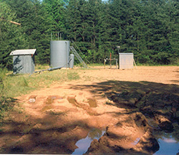
This is how the well looked in 1997. The wellhead Christmas tree is just to the left of the small gray building on the right. The tank that holds the crude oil brine is toward the left and another building holds equipment the operator uses to monitor the well's natural gas production.

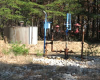
This was taken from the top of the tank's ladder. The well head is to the left with just a bit of the shed showing.
There have been a number of changes to the well over the years and we'll post photos of how it looks today.
Gas Well Site Visits
Examining Well Sites
How We Examined Well Sites
Environmental Assessment
Table with Links to Wells Visited
47-039-05714 Environmental Assessment
47-079-01492 Environmental Assessment
47-039-02026 Environmental Assessment
Gas Well Study is the examination of natural gas wells in West Virginia.
Underground Injection Control Class 2 Wells
These wells are used either for the disposal of oil and gas liquid waste or for the enhanced recovery of oil or natural gas.
Gas Well Study Site Visits
Annual reports, environmental assessments, and individual well information.
YouTube Videos
Select videos from the Gas Well Study YouTube channel.
What Happened at Fernow
An investigation into what caused the vegetation death in the land application area after landspraying hydraulic fracture flowback waste.
The Spill at Buckeye Creek
An investigation into a spill from a Marcellus well site into Buckeye Creek in Doddridge county.
The Details
Plunger Lift Technology on Gas Wells
Fluids Brought to the Surface during Production
Plugging a Well
How To Read a Lab Report
Information the Completion Report Provides
Casing and Cementing